 to view,
  to view/print using the Adobe Acrobat Reader®, or
 to download the indicated material.
Select
 for a description of the material.
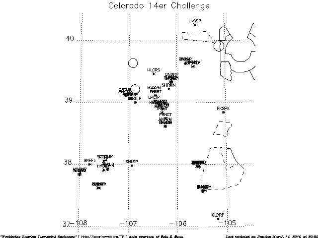
Unofficial Coordinates for the Colorado 14er Challenge Control Points
Courtesy of Colin J. Barry
Dated: 6 March 2010
Magnetic Variation: 9.7E
Time zone: US/Mountain, summer offset from GMT is -6:00 and in winter it is -7:00.
Information about the Challenge is available at 14er.coloradosoaring.org
The primary specification of the waypoint coordinates is degrees, minutes, and seconds
UNOFFICIAL, USE AT YOUR OWN RISK
Do not use for navigation, for flight verification only.
Always consult the relevant publications for current and correct
information. This service is provided free of charge with no warrantees,
expressed or implied.
User assumes all risk of use.
"Please note that private use airports in the FAA's National
Airspace System are for the use of the owner only or with the
permission of the owner only. Other users are not authorized
and should not be attempting to land at private use airports."
to view, to view/print using the Adobe Acrobat Reader®, or
to download the indicated material.
for a description of the material.
Control Points
[90.7 kB]
, or
[8.0 kB].
Files formatted for downloading and importing into your programs
 Map
[8.4 kB]
, [38.1 kB],
Map
[8.4 kB]
, [38.1 kB],  , or
, or  [2.1 kB]
 Task planner
 Airspace
Map Marking information [3.9 kB]
, or [4.5 kB].
Waypoint Names and Numbers [1.2 kB]
Waypoint Name Abbreviations, ICAO ID's, and Coordinates [7.1 kB]
Distance/Heading Matrix [17.7 kB]
,
or
[11.1 kB].
Change History
 Return to the Menu of North America Soaring Sites?
Please contact John Leibacher with any suggestions concerning this material.